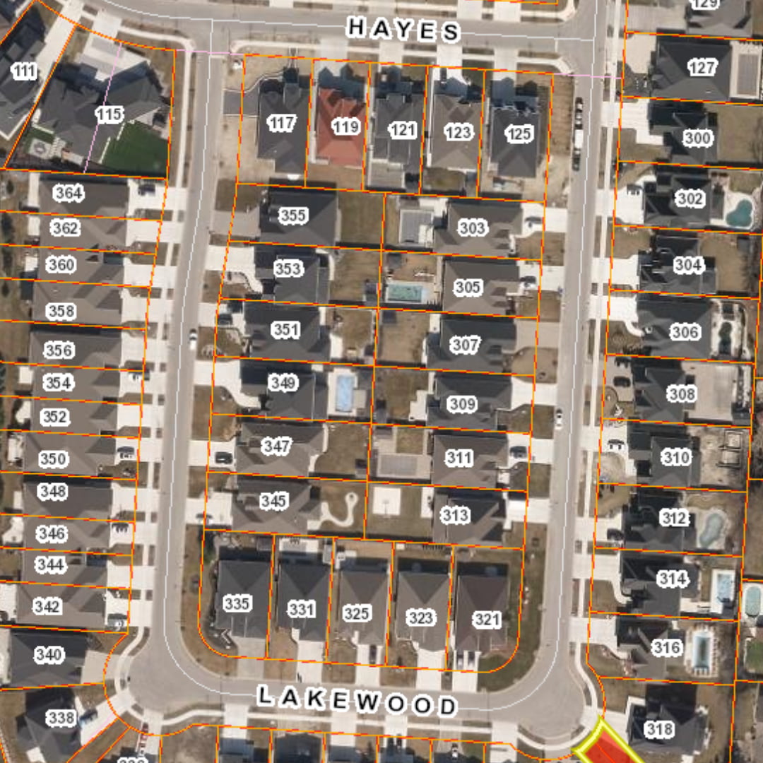
Seamlessly integrate accurate parcel boundaries into your existing GIS systems and mapping workflows.

Ontario Parcel
A trusted foundation for understanding property boundaries and parcel relationships across Ontario to optimize land management, support infrastructure and growth planning, and streamline analysis.
Ontario Parcel

A trusted foundation for understanding property boundaries and parcel relationships across Ontario to optimize land management, support infrastructure and growth planning, and streamline analysis.
Total Ontario coverage built from authoritative sources
As urban development and regional growth continue to reshape property boundaries and land use, the latest authoritative parcel data is essential for organizations to keep pace with evolving communities. With over 7.5 million properties and more than 10.4 million ownership, assessment, and Crown parcels across 54 jurisdictions, Ontario Parcel is the most comprehensive and up-to-date land database available.
Ontario Parcel is made possible through an agreement between the Ontario Ministry of Natural Resources (MNR), the Municipal Property Assessment Corporation (MPAC) and Teranet Enterprises Inc.

Ownership Parcel Data
Make more confident decisions with authoritative ownership parcel boundaries, connected to Property Identification Numbers (PINs) from Ontario’s official land registration system. The Ownership Parcel dataset helps organizations understand where properties are located and how they relate to the land registration framework, providing a reliable foundation for mapping, visualization, and location-based analysis across Ontario.

Assessment Parcel Data
Assessment Parcel data connects parcel boundaries with Assessment Roll Numbers (ARNs) from the Municipal Property Assessment Corporation (MPAC), helping organizations link taxable properties in Ontario to a reliable spatial view of the land they serve. This core dataset supports smarter taxation analysis, compliance, land administration, and planning across government, utility, and infrastructure operations.

Ontario Parcel Supporting Data
Parcel boundaries are only part of the picture. Strong GIS analysis requires the added context that helps turn parcel data into meaningful insight. By adding supporting data to Ownership and Assessment parcels, such as condominium plan limits, easements, rights-of-way, water body limits, political boundaries, and roads, this dataset helps you better interpret and visualize parcel information.
Parcel data for real operational needs
- Map Production and GIS System Integration
- Infrastructure Planning and Design
- Land Administration and Management
- Urban Planning and Development
- Taxation Analysis
- Utility Network Planning
Map Production and GIS System Integration
Infrastructure Planning and Design
Plan and design infrastructure projects with current data on land boundaries, access rights, and ownership.
Land Administration and Management
Maintain accurate, current land records for efficient land management, land-use planning, and spatial analysis.
Urban Planning and Development
Make informed decisions with reliable parcel boundaries and land-use data critical for smart and sustainable growth.
Taxation Analysis
Support accurate, defensible property taxation analysis with reliable parcel and assessment information.
Utility Network Planning
Current parcel data is necessary to forecast demand, optimize routes and service areas, and streamline maintenance.
Learn more about our partners


Get more parcel clarity with Core Title and Ownership Data
Enhance understanding and analysis with Title Data directly associated with the parcels, such as detailed ownership records, easement access rights, and address information.

Join 100s of customers that trust
Teranet for their spatial insights

I use it all the time, for me it is super helpful and a huge timesaver when investigating drainage complaints and future capital works projects. How did we live without it?
Paul, Drainage Engineer
City of Greater Sudbury